
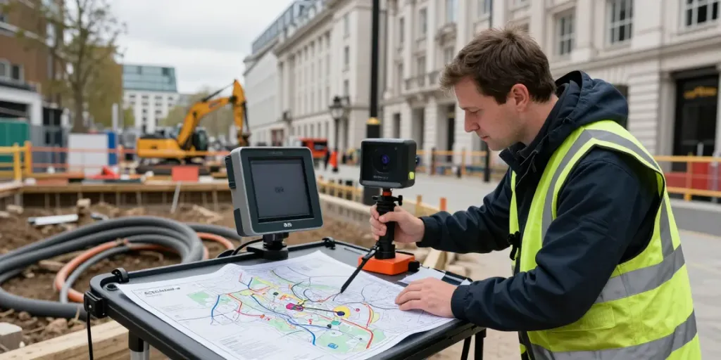
Understanding Underground Utility Surveys
In the bustling urban landscape of London, the presence of underground utilities is both a vital necessity and a potential hazard for construction and development projects. Understanding the intricacies of underground utility surveys is crucial for engineers, contractors, and property developers aiming to ensure the success of their projects while adhering to safety standards. Comprehensive surveys unveil the hidden networks of services, including gas, electricity, water, and telecommunications, allowing for informed decision-making during the planning and execution phases. When exploring options, Underground Utility Survey London provides comprehensive insights that help mitigate risks associated with underground infrastructure.
What is an Underground Utility Survey?
An underground utility survey is a systematic process aimed at identifying and mapping the location, depth, and type of buried utilities beneath the surface of the land. This type of survey is pivotal prior to any excavation or construction work. Surveys can utilise various methods, including visual inspections, existing utility record analysis, and advanced technologies like Ground Penetrating Radar (GPR) and Electromagnetic Locating.
Key Importance of Utility Surveying
The importance of utility surveying in London cannot be understated. As the city continues to expand and develop, the underground landscape becomes increasingly congested. Accurately locating utilities helps prevent costly mistakes, enhances safety for workers and the public, and facilitates compliance with legal and regulatory requirements. Additionally, having precise utility maps can significantly streamline project timelines and reduce the risk of delays caused by uncovering uncharted utilities during excavation.
Common Techniques and Technologies Used
Several techniques are employed in the field of underground utility surveying. These include:
- Ground Penetrating Radar (GPR): A non-invasive method that uses radar pulses to image the subsurface, GPR is effective in locating various types of utilities.
- Electromagnetic Locating: This technique detects buried metallic utilities by measuring their electromagnetic fields.
- CAT Scanning: A cable avoidance tool (CAT) is commonly used to locate and trace electrical cables and some types of pipes.
- Surveying Records Analysis: Consulting existing utility plans and records to verify the locations of known utilities.
Benefits of Underground Utility Survey London
Preventing Construction Errors and Delays
One of the primary benefits of conducting thorough underground utility surveys is the prevention of construction errors. Unplanned encounters with utilities can lead to significant delays, increased costs, and, in some cases, legal ramifications. By accurately mapping existing utilities before commencing work, companies can avoid damaging vital services, thereby ensuring a smoother workflow.
Enhancing Safety During Excavation
Safety is paramount on any construction site. Underground utility surveys play a crucial role in protecting workers by identifying potential hazards before excavation begins. This proactive approach reduces the likelihood of accidents, such as gas line ruptures or electrical shock, which can have dire consequences.
Cost-Effective Solutions for Property Development
Investing in an underground utility survey can significantly reduce overall project costs. By identifying and avoiding potential issues early in the project lifecycle, developers can save on repair costs, avoid project delays, and optimise operational efficiency. Furthermore, a comprehensive utility plan allows for better resource allocation, ultimately leading to more successful property developments.
Best Practices in Conducting Utility Surveys
Preparation and Site Assessment Guidelines
Before initiating a utility survey, conducting thorough preparation and site assessment is critical. This may include:
- Gathering existing utility maps and records.
- Understanding the specific site conditions and potential challenges.
- Engaging with local utility companies for insights into additional utilities that may not be documented.
Choosing the Right Surveying Technology
The choice of technology should be based on the specific requirements of the project. For instance, GPR is particularly effective in urban environments where multiple utilities may be present. However, in areas with shallow utilities or where precision is paramount, electromagnetic locating tools may be preferable.
Interpreting Survey Data Accurately
Accurate interpretation of survey data is essential for effective planning. Surveyors must be trained in reading and understanding the complex data outputs generated by various surveying technologies. Additionally, it is crucial to communicate findings clearly to all stakeholders involved in the project.
Challenges and Solutions in the Surveying Process
Common Misconceptions About Utility Surveys
There are several misconceptions surrounding underground utility surveys, one of which is that they can guarantee the complete absence of utilities below the surface. In reality, while surveys vastly improve knowledge about existing utilities, unforeseen elements may still exist. It’s essential to combine survey data with ongoing field assessments throughout the project lifecycle.
Dealing with Complex Urban Environments
London's urban landscape presents unique challenges for utility surveying. Dense infrastructure and extensive subterranean networks can complicate accurate mapping. Utilising a combination of multiple surveying techniques and technologies, as well as involving skilled professionals with experience in navigating urban complexities, can significantly enhance survey accuracy.
Case Studies of Successful Surveys in London
Several successful underground utility surveys in London exemplify best practices. For instance, a prominent construction project in Westminster utilised GPR for initial mapping, followed by electromagnetic locating to confirm the presence of underground utilities. The pre-emptive measures resulted in a smooth excavation process, with no disruptions to existing services.
Future Trends in Underground Utility Surveying
Innovations on the Horizon: What’s Next?
The future of underground utility surveying is poised for significant advancements with the integration of AI and machine learning. These technologies could enhance data analysis, providing more accurate predictions regarding utility locations and potential conflicts.
Impact of Technology on Surveying Accuracy
As technology continues to evolve, the accuracy of utility surveys is also improving. Innovations such as 3D mapping and augmented reality systems are becoming more prevalent, allowing surveyors to visualise underground utilities in real time, which can profoundly impact construction planning and risk management.
Preparing for the Future of Urban Infrastructure
City planners and developers must prepare for the growing complexity of urban infrastructure. This includes investing in comprehensive surveying techniques and staying abreast of emerging technologies that can facilitate better urban planning.
How to check for underground utilities in the UK?
In the UK, individuals and companies can check for underground utilities by engaging licensed utility surveyors who use both technology and existing utility maps to identify potential subsurface services.
How much does a home survey typically cost in London?
The cost of a home utility survey in London can vary based on factors such as the size of the property and the complexity of the underground services, but it typically ranges from £300 to £1,500.
What are the best survey companies in the UK?
Several companies in the UK are renowned for their expertise in utility surveying, including Cadmap, Omega Geo, and Terrain Surveys, each offering unique capabilities and technologies that cater to a range of surveying needs.